Collection: Travel and Transportation Maps & Books - Antique
Use the "Filter By" tool to sort by location or type.
-
1838 - Bowen's Picture of Boston, or the Citizen's and Stranger's Guide to the Metropolis of Massachusetts, and Its Environs to Which is Affixed the Annals of Boston Embellished with Engravings - Antique Map
![Genuine-Antique-Book-with-Maps-Bowen's-Picture-of-Boston-or-the-Citizen's-and-Stranger's-Guide-to-the-Metropolis-of-Massachusetts-and-Its-Environs-to-Which-is-Affixed-the-Annals-of-Boston-Embellished-with-Engravings-1838-Abel-Bowen-Maps-Of-Antiquity]()

- Regular price
- $250.00
- Sale price
- $250.00
- Regular price
-
- Unit price
- per
Sold out -
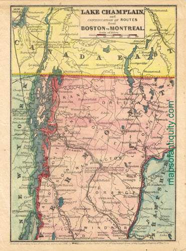
1848 - Lake Champlain and Continuation of Routes from Boston to Montreal - Antique Map
![Antique-Hand-Colored-Map-Lake-Champlain-and-Continuation-of-Routes-from-Boston-to-Montreal-New-England--1848-W.-Williams-Maps-Of-Antiquity]()
- Regular price
- $75.00
- Sale price
- $75.00
- Regular price
-
- Unit price
- per
Sold out -
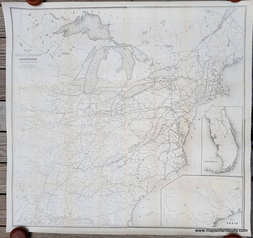
1853 - Map of the Railroads in the United States in Operation and Progress - Antique Map
![Genuine-Antique-Map-Map-of-the-Railroads-in-the-United-States-in-Operation-and-Progress-1853-Israel-D-Andrews-Maps-Of-Antiquity]()
- Regular price
- $750.00
- Sale price
- $750.00
- Regular price
-
- Unit price
- per
Sold out -
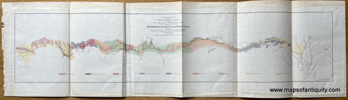
1854 - Geological Map of the Route explored by Lieut. A. W. Whipple, from the Mississippi River to the Pacific Ocean 1853-1854. - Antique Map
![Antique-Geologic-Map-U.S.-Pacific-Rail-Road-Explorations-and-Surveys-War-Department--Geological-Map-of-the-Route-explored-by-Lieut.-A.-W.-Whipple-from-the-Mississippi-River-to-the-Pacific-Ocean-1853-1854.**********-United-States-West-1853-William-P.-Blake-Maps-Of-Antiquity]()
- Regular price
- $165.00
- Sale price
- $165.00
- Regular price
-
- Unit price
- per
Sold out -
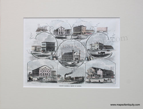
1857 - Various Railroad Depots in Boston - Antique Print
![Genuine-Hand-Colored-Antique-Print-Various-Railroad-Depots-in-Boston-1857-Ballou's-Pictorial-Maps-Of-Antiquity]()
- Regular price
- $65.00
- Sale price
- $65.00
- Regular price
-
- Unit price
- per
Sold out -
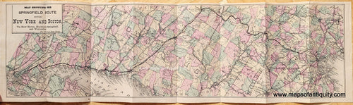
1867 - Map showing the Springfield Route between New York and Boston, via New Haven, Hartford, Springfield, and Worcester. - Antique Railroad Map
![Genuine-Antique-Railroad-Booklet-and-Map-Map-showing-the-Springfield-Route-between-New-York-and-Boston-via-New-Haven-Hartford-Springfield-and-Worcester.-1867-Walling-/-Taintor-Brothers-Maps-Of-Antiquity]()
- Regular price
- $275.00
- Sale price
- $275.00
- Regular price
-
- Unit price
- per
Sold out -
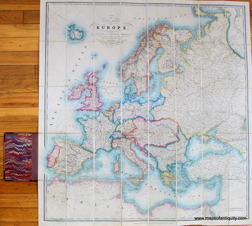
1869 - Tourist Map of Europe. Shewing the Railways and Steam Communications - Antique Map
![Hand-Colored-Antique-Folding-Tourist-Map-Tourist-Map-of-Europe.-Shewing-the-Railways-and-Steam-Communications-Europe-General-Folding-1869-Cruchley-Maps-Of-Antiquity]()
- Regular price
- $750.00
- Sale price
- $750.00
- Regular price
-
- Unit price
- per
Sold out -
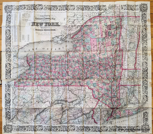
1872 - Colton's Railroad and Township Map of the State of New York with Parts of the Adjoining States and Canada. - Antique Map
![Genuine-Antique-Hand-Colored-Map-Colton's-Railroad-and-Township-Map-of-the-State-of-New-York-with-Parts-of-the-Adjoining-States-and-Canada.--United-States-Northeast-1872-Colton-Maps-Of-Antiquity-1800s-19th-century]()
- Regular price
- $325.00
- Sale price
- $325.00
- Regular price
-
- Unit price
- per
Sold out -
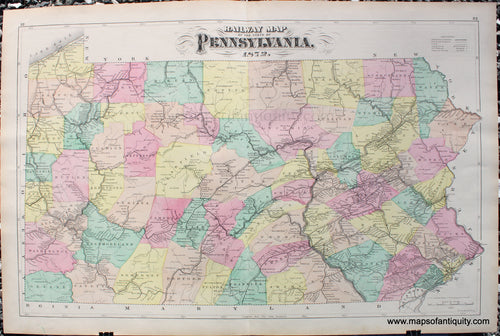
1872 - Railway Map of the State of Pennsylvania - Antique Map
![Antique-Map-Railway-Pennsylvania-1872-Walling-Gray-1870s-1800s-railroad-rail-road-way]()
- Regular price
- $175.00
- Sale price
- $175.00
- Regular price
-
- Unit price
- per
Sold out -
1873 - Map of The Flushing and North Side Rail Road - Antique Map
![]()

- Regular price
- $35.00
- Sale price
- $35.00
- Regular price
-
- Unit price
- per
Sold out -
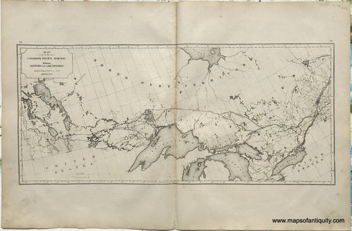
1875 - Map of the Canadian Pacific Railway. Between Manitoba and Lake Nipissing. - Antique Map
![Antique-Map-Map-of-the-Canadian-Pacific-Railway.-Between-Manitoba-and-Lake-Nipissing.-1875-Walling-/-Tackabury-Canada-Civil-War-1800s-19th-century-Maps-of-Antiquity]()
- Regular price
- $75.00
- Sale price
- $75.00
- Regular price
-
- Unit price
- per
Sold out -
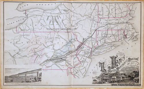
1876 - Map of the South Mountain and Boston Rail Road Connections... - Antique Map
![Genuine-Antique-Map-Map-of-the-South-Mountain-and-Boston-Rail-Road-Connections…-1876-Reading-Publishing-House-Maps-Of-Antiquity]()
- Regular price
- $150.00
- Sale price
- $150.00
- Regular price
-
- Unit price
- per
Sold out -
1878 - N. J. Railroad Map, Sea Island to Absecon Beach - Antique Map
![Antique-Railroad-Map-N.-J.-Railroad-Map-Sea-Island-to-Absecon-Beach-United-States-New-Jersey-1878-Woolman-&-Rose-Maps-Of-Antiquity]()

- Regular price
- $125.00
- Sale price
- $125.00
- Regular price
-
- Unit price
- per
Sold out -
1883/1973 - New and Correct Map of the Great Rock Island Route - Antique Map
![Vintage-Facsimile-of-an-Antique-Map-New-and-Correct-Map-of-the-Great-Rock-Island-Route-1883-1973-Chicago,-Rock-Island-Pacific-Railway-Maps-Of-Antiquity]()

- Regular price
- $100.00
- Sale price
- $100.00
- Regular price
-
- Unit price
- per
Sold out -
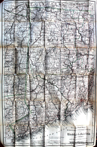
1886 - Colton's Road Map of Litchfield and Fairfield Counties of Western Connecticut - Antique Map
![Antique-Folding-Map-Colton's-Road-Map-of-Litchfield-and-Fairfield-Counties-of-Western-Connecticut-Connecticut-Folding-Maps-1886-Colton-Maps-Of-Antiquity]()
- Regular price
- $450.00
- Sale price
- $450.00
- Regular price
-
- Unit price
- per
Sold out -
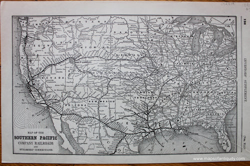
1889 - Map of the Southern Pacific Company Railroads and Steamship Connections - Antique Map
![Antique-Uncolored-Map-Map-of-the-Southern-Pacific-Company-Railroads-and-Steamship-Connections-United-States--1889-Southern-Pacific-Railroad-Company-Maps-Of-Antiquity]()
- Regular price
- $50.00
- Sale price
- $50.00
- Regular price
-
- Unit price
- per
Sold out -
1890 - Tourist Map of the Boston and Maine Railroad - Antique Map
![Genuine-Antique-Book-with-Map-Tourist-Map-of-the-Boston-and-Maine-Railroad-1890-Boston-&-Maine-Railroad-Maps-Of-Antiquity]()

- Regular price
- $115.00
- Sale price
- $115.00
- Regular price
-
- Unit price
- per
Sold out -
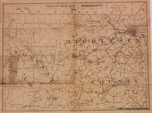
1891 - Cyclists Road Map of Massachusetts, Part 3 - Antique Map
![Antique-Map-Cyclists-Road-Map-of-Massachusetts-Part-3]()

- Regular price
- $95.00
- Sale price
- $95.00
- Regular price
-
- Unit price
- per
Sold out -
1891 - Cyclists Road Map of Massachusetts, Part 5 - Antique Map
![Antique-Map-Cyclists-Road-Map-of-Massachusetts-Part-5]()
- Regular price
- $95.00
- Sale price
- $95.00
- Regular price
-
- Unit price
- per
Sold out -
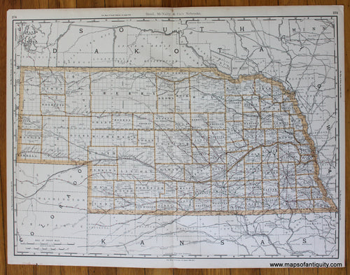
1891 - Nebraska - Antique Map
![Antique-Printed-Color-Map-Nebraska-United-States-Midwest-1891-Grant-Maps-Of-Antiquity]()

- Regular price
- $50.00
- Sale price
- $50.00
- Regular price
-
- Unit price
- per
Sold out -
1892 - Northern Vermont - Antique Map
![Genuine-Antique-Book-with-Maps-Northern-Vermont-1892-Rand-Avery-Supply-Co-Boston--Maine-Railroad-Maps-Of-Antiquity]()
- Regular price
- $195.00
- Sale price
- $195.00
- Regular price
-
- Unit price
- per
Sold out -
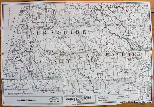
1893 - Cyclists Road Map of Massachusetts, Part 2 - Southern Berkshire, Hampshire, Hampden counties - Antique Map
![Antique-Map-Cyclists-Road-Map-of-Massachusetts-Part-2-Berkshire-Hampshire-Hampden-counties-1893-Robinson-Bicycle-Bicyclist-1890s-1800s-19th-century-Maps-of-Antiquity]()
- Regular price
- $95.00
- Sale price
- $95.00
- Regular price
-
- Unit price
- per
Sold out -
1893 - Cyclists Road Map of Massachusetts, Part 4 - Hampshire, Hampden, and Worcester counties - Antique Map
![Antique-Map-Cyclists-Road-Map-of-Massachusetts-Part-4-Hampshire-Hampden-Worcester-counties-1893-Robinson-Bicycle-Bicyclist-1890s-1800s-19th-century-Maps-of-Antiquity]()

- Regular price
- $95.00
- Sale price
- $95.00
- Regular price
-
- Unit price
- per
Sold out -
1893 - Cyclists Road Map of Massachusetts, Part 9 - Bristol and Plymouth counties - Antique Map
![Antique-Map-Cyclists-Road-Map-of-Massachusetts-Part-9-Bristol-Plymouth-counties-1893-Robinson-Bicycle-Bicyclist-1890s-1800s-19th-century-Maps-of-Antiquity]()

- Regular price
- $95.00
- Sale price
- $95.00
- Regular price
-
- Unit price
- per
Sold out -
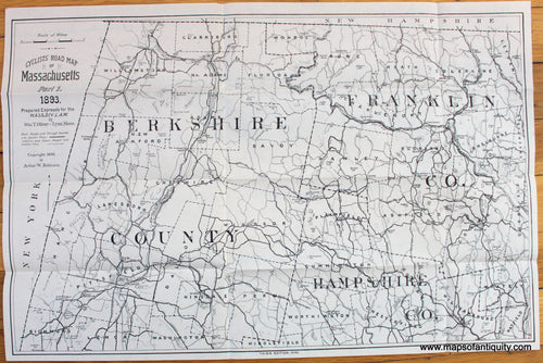
1893 - Cyclists' Road Map of Massachusetts - Part 1 - Northern Berkshire, Franklin, and Hampshire counties - Antique Map
![Antique-Cyclists-Road-Map-Massachusetts-Berkshire-Franklin-Hampshire-counties-Bicycle-Bicyclist-1893-Robinson-1890s-1800s-19th-century-Maps-of-Antiquity]()
- Regular price
- $95.00
- Sale price
- $95.00
- Regular price
-
- Unit price
- per
Sold out -
1893 - Nebraska - Antique Map
![Antique-Printed-Color-Map-Nebraska-United-States-Midwest-1893-Rand-McNally-Maps-Of-Antiquity]()
- Regular price
- $50.00
- Sale price
- $50.00
- Regular price
-
- Unit price
- per
Sold out -
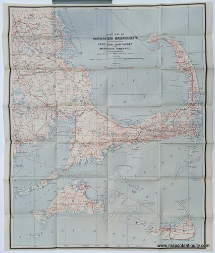
1895 - Road Map of Southeastern Massachusetts Cape Cod, Nantucket, and Martha's Vineyard - Antique Map
![Genuine Antique Printed Color Map-Road Map of Southeastern Massachusetts Cape Cod, Nantucket, and Martha's Vineyard-c. 1895-J.F. Murray / Old Colony Railroad-Maps-Of-Antiquity-1800s-19th-century]()
- Regular price
- $350.00
- Sale price
- $350.00
- Regular price
-
- Unit price
- per
Sold out -
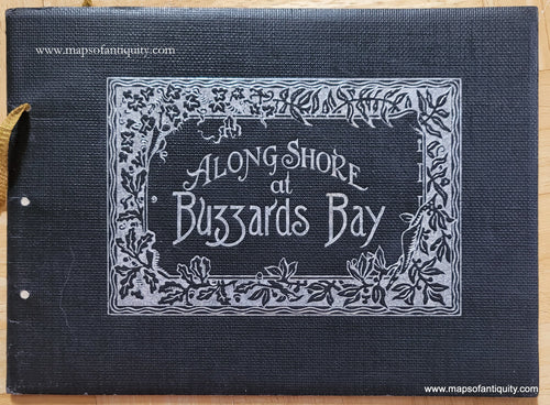
1896 - Along Shore at Buzzards Bay - Antique
![Genuine-Antique-Photogravure-Book-Along-Shore-at-Buzzards-Bay-1896-W.L.-Kelley-Maps-Of-Antiquity]()
- Regular price
- $85.00
- Sale price
- $85.00
- Regular price
-
- Unit price
- per
Sold out -
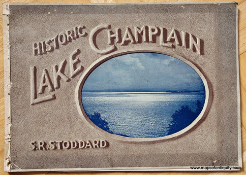
1898 - Historic Lake Champlain - Antique
![Genuine-Antique-Photogravure-Book-Historic-Lake-Champlain-1898-Stoddard-Maps-Of-Antiquity]()
- Regular price
- $85.00
- Sale price
- $85.00
- Regular price
-
- Unit price
- per
Sold out -
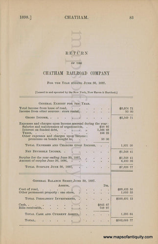
1898 - Return of the Chatham Railroad Company for the Year ending June 30, 1897. - Antique
![Antique-Pages-Return-of-the-Chatham-Railroad-Company-for-the-Year-ending-June-30-1897.-1897-Chatham-1800s-19th-century-Maps-of-Antiquity]()
- Regular price
- $25.00
- Sale price
- $25.00
- Regular price
-
- Unit price
- per
Sold out -
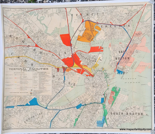
1899 - Terminal Facilities of Boston - Antique Map
![Genuine-Antique-Map-Terminal-Facilities-of-Boston-1899-Walker-Maps-Of-Antiquity]()
- Regular price
- $350.00
- Sale price
- $350.00
- Regular price
-
- Unit price
- per
Sold out -
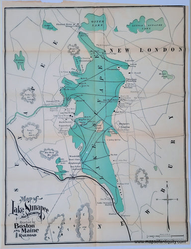
1900 - Map of Lake Sunapee and Vicinity Reached by Boston and Maine Railroad - Antique Map
![Antique-Map-of-Lake-Sunapee-and-Vicinity-Reached-By-Boston-and-Maine-Railroad-New-Hampshire-Rand-Avery-Supply-Co-1900-1900s-Early-20th-Century-Maps-of-Antiquity]()
- Regular price
- $145.00
- Sale price
- $145.00
- Regular price
-
- Unit price
- per
Sold out


- Page 1 of 5
- Next page